Inundation Mapping Tool
Use our searchable tool to look up your location in Central Fresno County to see if you could be affected by potential flooding.
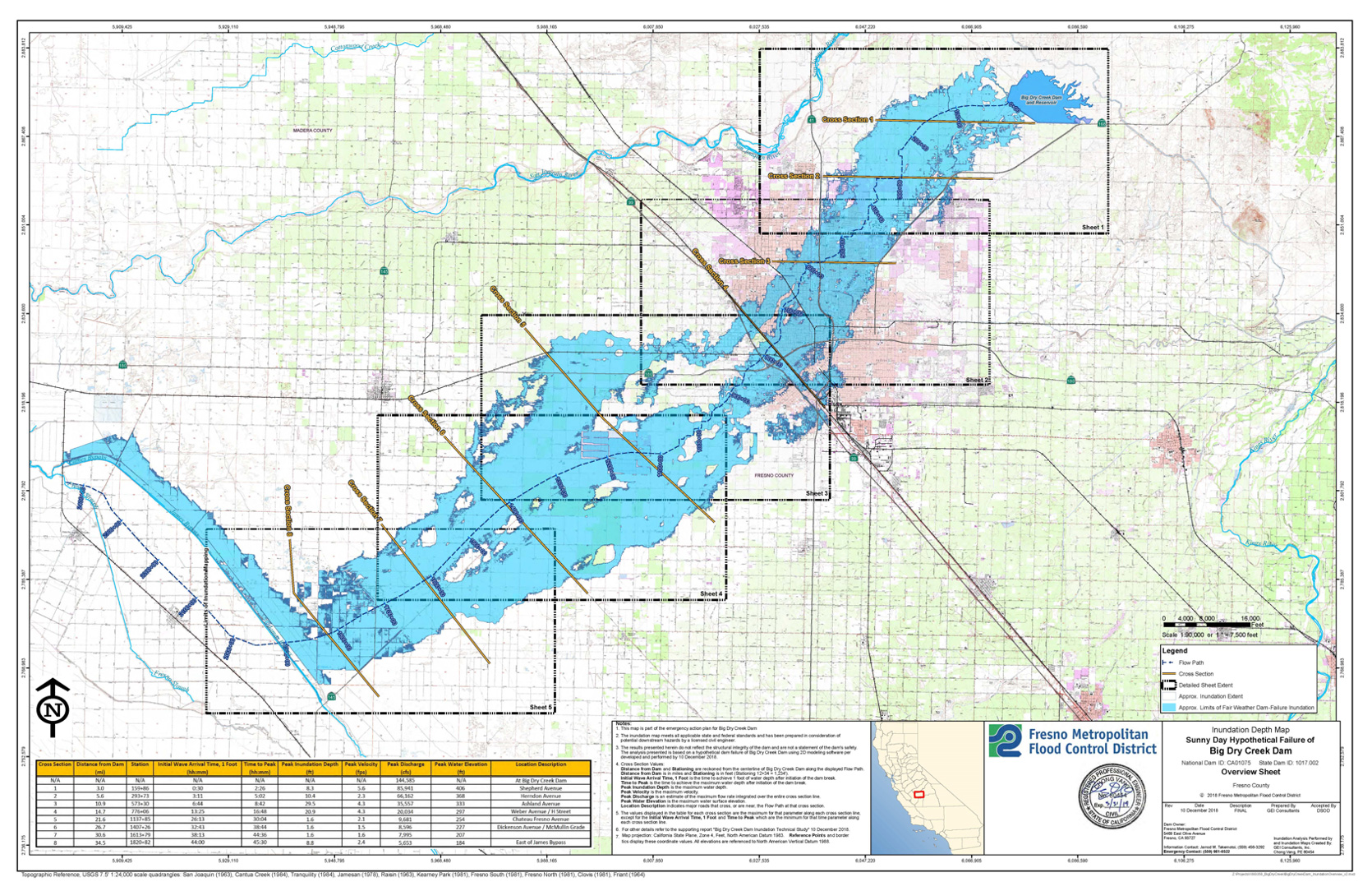
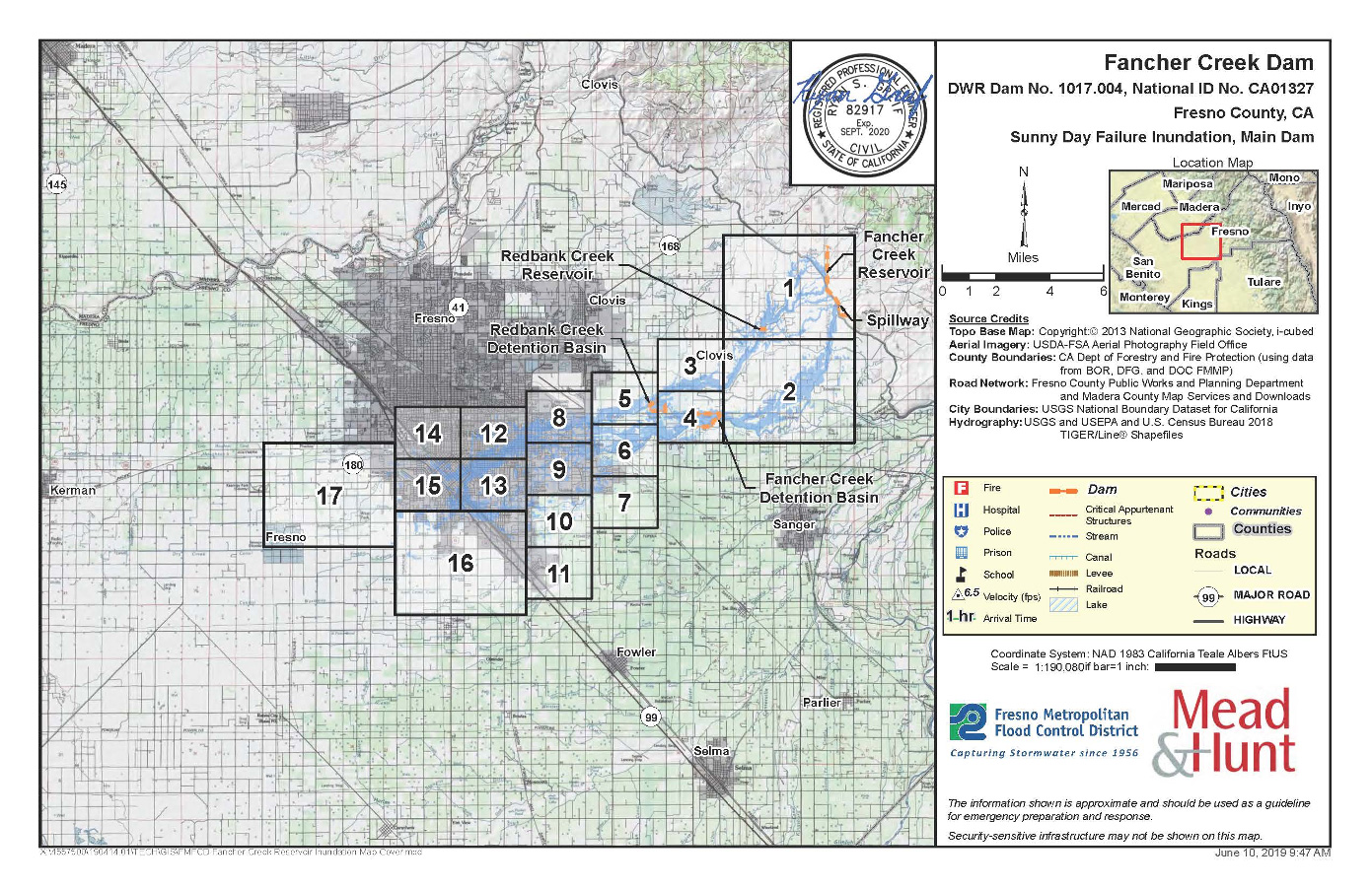
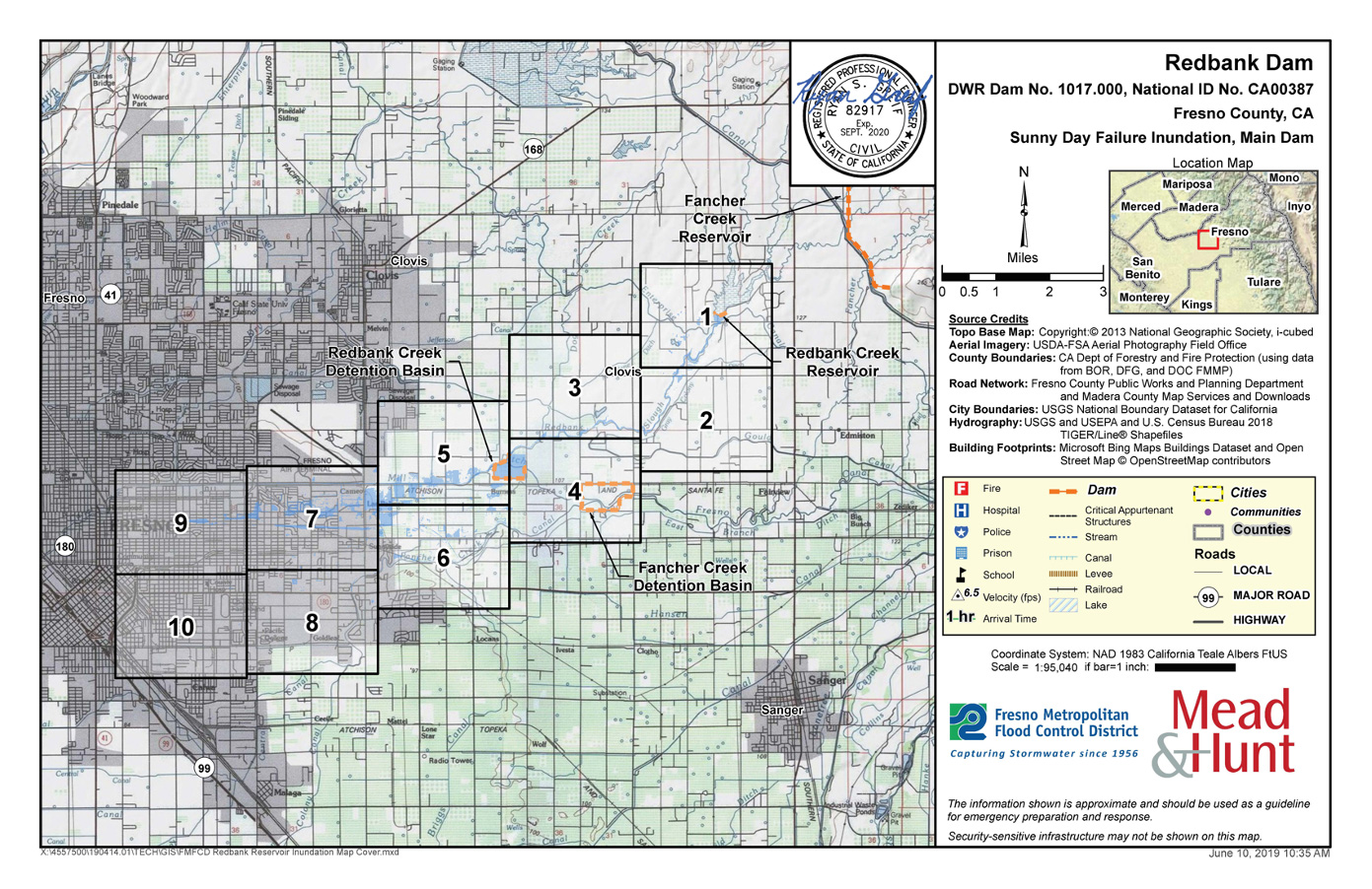
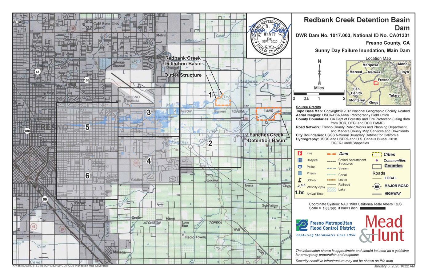
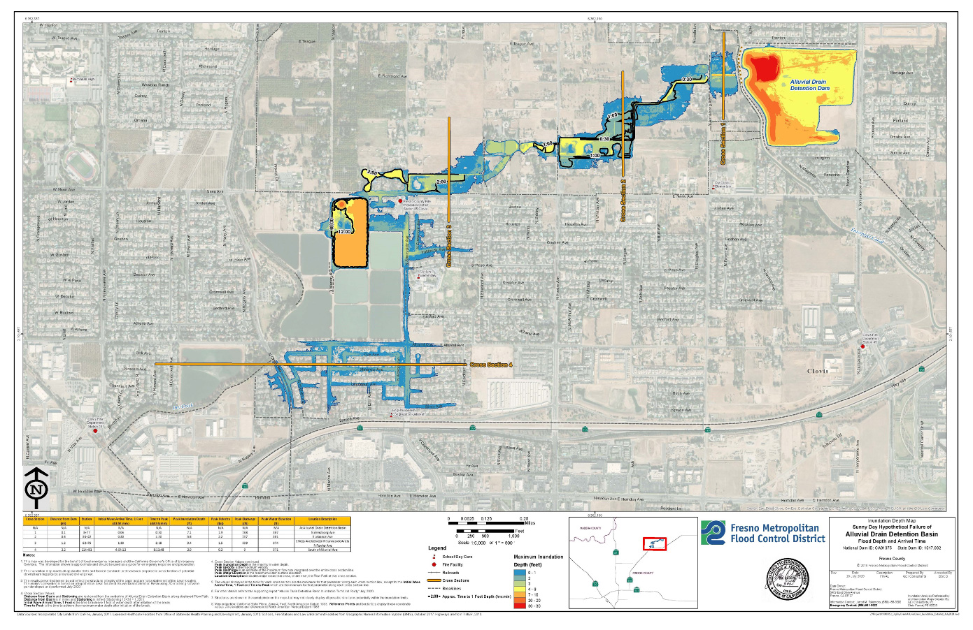
What Are Inundation Maps?
Inundation maps show flooding that could result from a hypothetical failure of a dam or its critical appurtenant structures, such as spillways or outlet gates.
What Is the Purpose of Inundation Maps?
The primary purpose of an inundation map is to show the areas that would be flooded and travel times for wavefront and flood peaks at critical locations if a dam failure occurs. Inundation maps are used by both the dam owner and emergency management authorities to facilitate timely notification and evacuation of areas potentially affected by dam failure or flood condition.